Global Monitoring Laboratory
Earth System Research Laboratories
Name
Last modified
Size
Description
Parent Directory
-
acse_cordex/
2020-01-29 09:38
-
asre/
2022-12-02 11:53
-
cheesehead/
2023-06-23 12:33
-
cires_outreach/
2023-05-13 10:35
-
goes16/
2022-04-01 15:13
-
rand_forest/
2023-09-11 13:34
-
sgp/
2022-08-31 11:49
-
splash/
2023-09-21 13:07
-
surfrad/
2022-10-17 16:25
-
to_hagen/
2020-11-24 18:17
-
to_vanessa/
2020-11-20 10:05
-
tsi/
2020-03-30 22:54
-
twst/
2023-10-18 13:13
-
wfip2/
2022-11-16 08:27
-
wfip3/
2023-12-06 13:41
-
wildfires/
2023-04-27 12:58
-
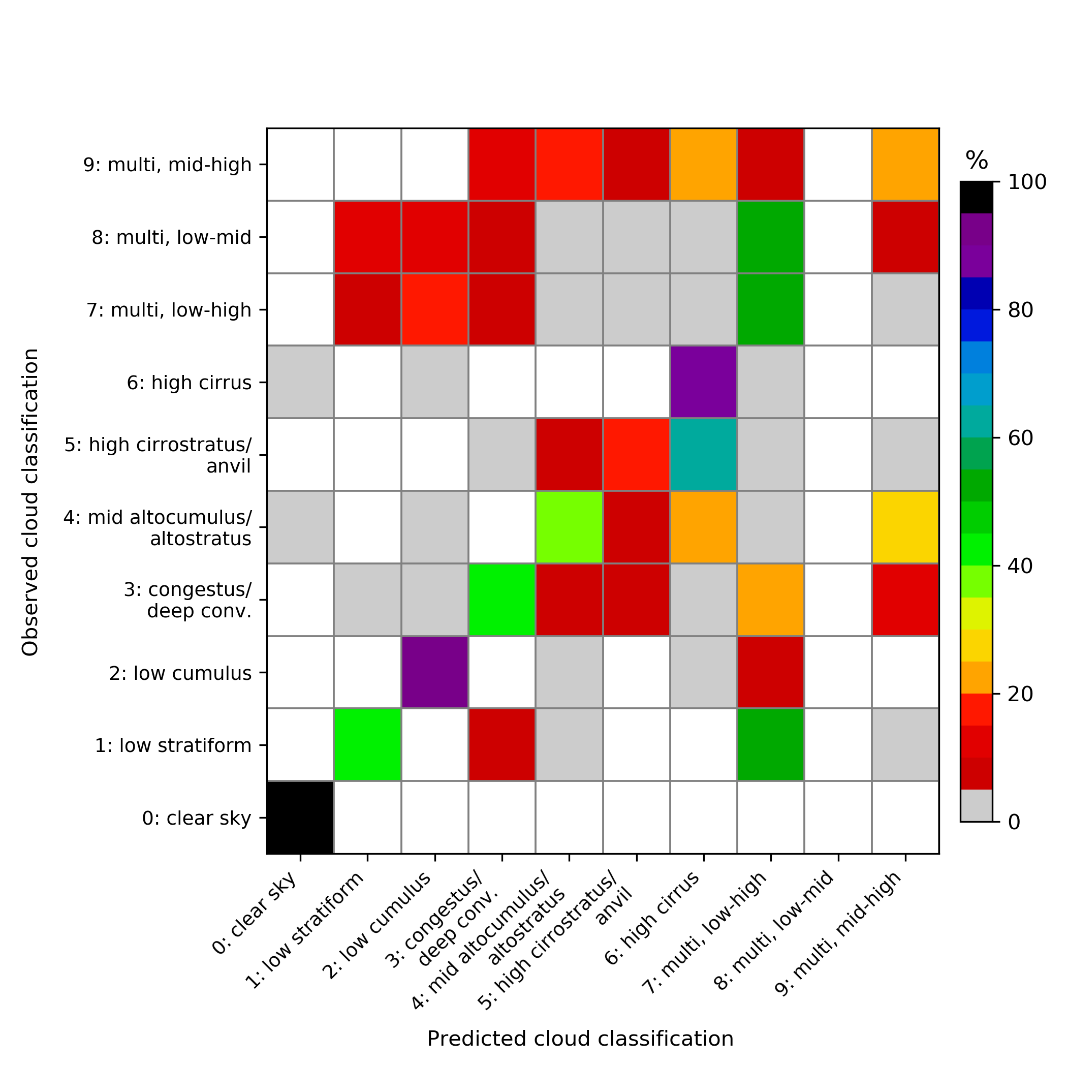
confusion_matrix_cld_class_model_v6.3_2008-2013_TWP-C3_updated_gridlines_colormap_2nd_revision.png
2021-01-13 10:20
268K
hrrr_control_reforecast_1d_sfc_vars_bilinear_wfip2_wasco.nc
2020-08-19 12:20
8.3M
L1_PSU_202005300000_p1950283.nc
2020-06-01 08:31
19M
L2_PSU_202005300000_p1950283.nc
2020-06-01 08:31
36M
L3_DEFAULT_PSU_202005300000_1_360_1_3120_10_30_4000_3_0_1_500_1000_4000_60_p1950283.nc
2020-06-01 08:31
38M
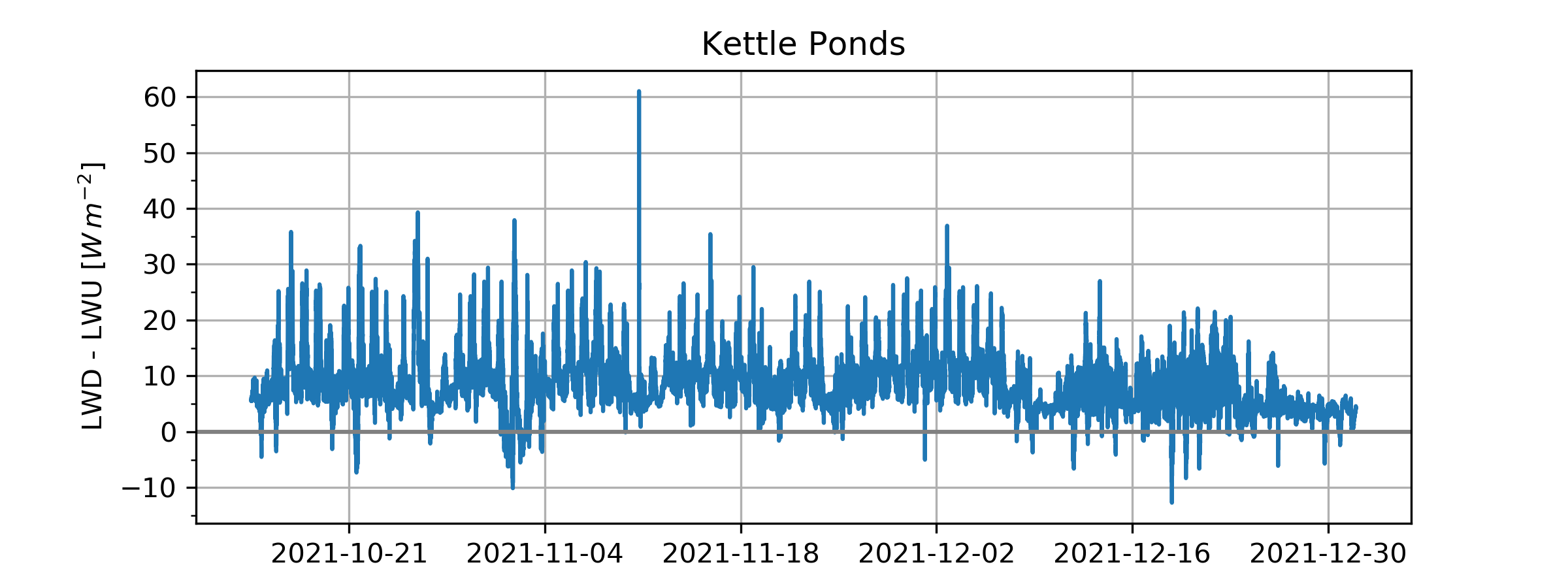
lwd-lwu_ckp_splash_2021_timeseries.png
2022-01-13 19:57
125K
qcrad_wasco_wfip2.nc
2020-08-19 12:20
234M
refcst.01.fcst.02.20170108.000000.a2e.wfip2.nc
2020-08-18 10:29
14M
refcst.01.fcst.02.20170108.120000.a2e.wfip2.nc
2020-08-18 10:29
14M
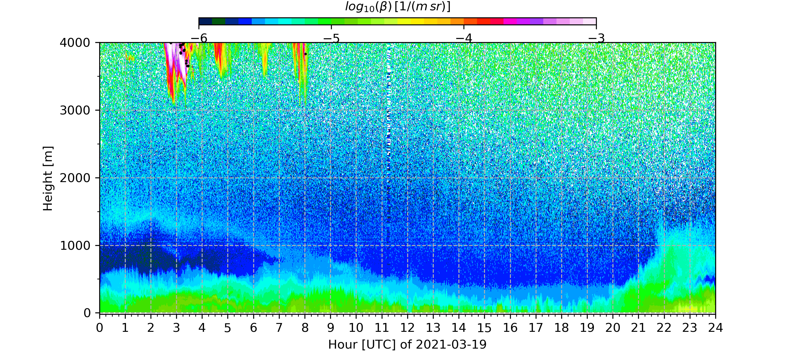
TBL_CL51_attenuated_backscat_cbh1_0-4km_2021-03-19.png
2021-03-22 11:42
1.4M
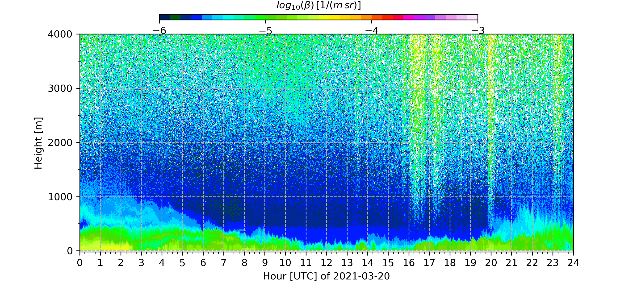
TBL_CL51_attenuated_backscat_cbh1_0-4km_2021-03-20.png
2021-03-22 11:42
1.5M
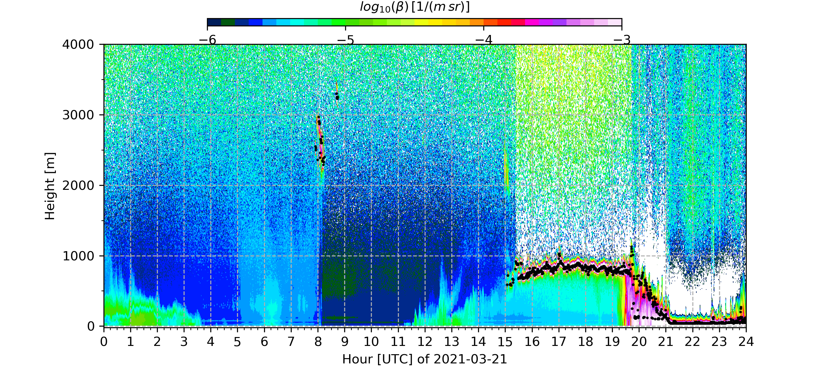
TBL_CL51_attenuated_backscat_cbh1_0-4km_2021-03-21.png
2021-03-22 11:42
1.5M
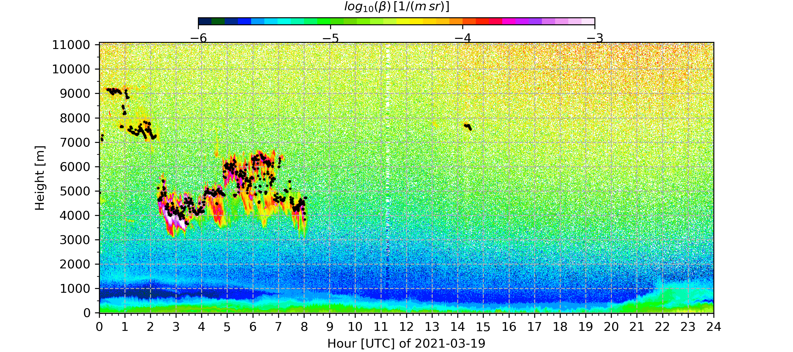
TBL_CL51_attenuated_backscat_cbh1_2021-03-19.png
2021-03-22 11:17
2.1M
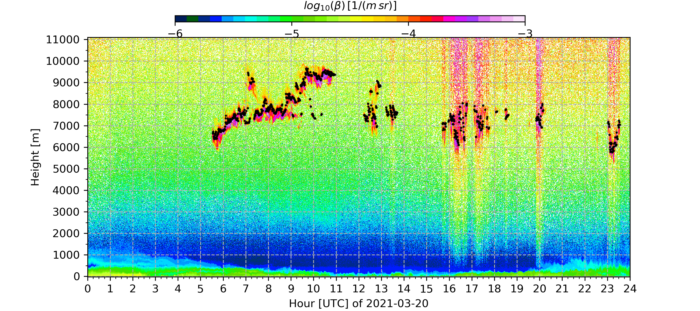
TBL_CL51_attenuated_backscat_cbh1_2021-03-20.png
2021-03-22 11:17
2.2M
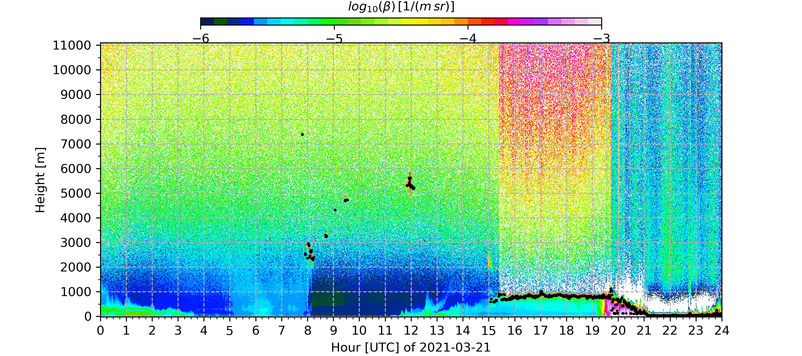
TBL_CL51_attenuated_backscat_cbh1_2021-03-21.png
2021-03-22 11:17
2.1M
tbl_concat_surfrad_2020.nc
2020-11-16 23:01
56M
TBL_temporary_l2_backscat_cbh1_mean_mlh_2021-03.nc
2021-03-22 10:13
119M
vars_in_daves_nc.log
2022-01-11 10:42
27K