
Briggsdale, Colorado, United States
| Latitude | variable | |||
| Longitude | variable | |||
| Elevation | variable | |||
| Site code | CAR | |||
| Dataset | co2_car_aircraft-pfp_1_allvalid (GLOBALVIEW identifier CAR_01P2) | |||
| Assimilated | No | |||
| Selection scheme | all valid measurements | |||
| Data provider | Colm Sweeney, National Oceanic and Atmospheric Administration, NOAA ESRL GMD, 325 Broadway GMD-1, Boulder, CO 80305-3328, United States | |||
| Laboratory |
| |||
| Download these data via ObsPack. | ||||

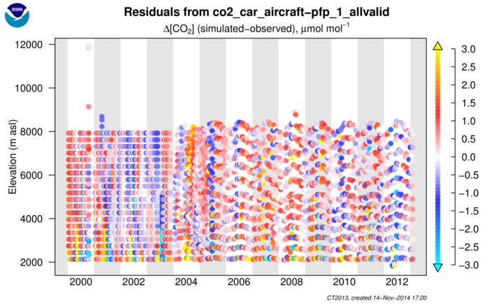
Figure 1.
Residuals (simulated - observed) for aircraft profiles at the
specified site, shown as a function of date and sample elevation.
Units are μmol mol-1 of CO2. Each dot represents one observation. Aircraft
data are not assimilated in CarbonTracker.
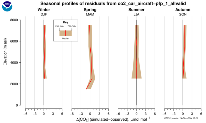
Figure 2. Statistical summary of residuals (simulated - observed) for aircraft profiles at the specified site, shown as a function of season and elevation. Units are μmol mol-1 of CO2. The shaded area spans the 25th to 75th quantile range, with the median residuals given by the red line. These statistics are generated using all observations falling within the specified months and within each 1000m layer. Aircraft data are not assimilated in CarbonTracker.