
Analysis of Source Distribution of High GHGs and CO Events using Airborne and Surface Observations in Korea
S. Lee, H. Lee, S.T. Kenea, C. Chung and Y. Kim
National Institute of Meteorological Sciences, Innovative Meteorological Research Department, Seogwipo-si, Jeju-do, South Korea; 82-64-780-6649, E-mail: sunranlee@korea.kr
Anmyeon-do (AMY, 36.54° N, 126.33° E), a World Meteorological Organization/Global Atmosphere Watch Program (WMO/GAW) regional background station in Korea, provides continuous observations of GHGs and CO mole fractions at the surface and vertical profiles within 0.5-9 km that are also collected by aircraft campaigns. We captured a strong GHGs and CO signal within boundary layer and above the BLH at about 2 km, where vertical profiles of the aerosol scattering coefficient at 550 nm were simultaneously observed with the same vertical structure. We identified the origins and source types of the pollution plume stratification for GHGs, CO and aerosol, we also analyzed surface in-situ observations of particle size distributions and reactive gases (NOx, O3, and SO2) as well as XCO and aerosol optical depth measurements from tropospheric monitoring instrument (TROPOMI) and moderate resolution imaging spectroradiometer (MODIS) satellite, respectively. The high GHGs and CO event within the BLH, including observations at the surface site, was attributed to domestic burning sources such as biofuel of vehicles. Convective uplifting of industrial fossil fuel emissions from Eastern China was responsible for the high GHGs and CO dry mole fraction in the low free troposphere (FT) and elevated aerosol scattering coefficient. Atmospheric pollution plume stratification in the troposphere should be considered for future radiative forcing studies to improve air-quality forecasting in this region.
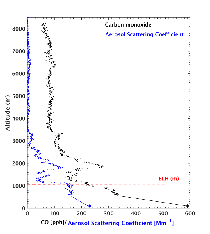
Figure 1. Vertical profiles of CO and aerosol scattering coefficient observed over the Anmyeon-do(AMY, 36.53° N, 126.33° E) station using aircraft on November 16, 2019.
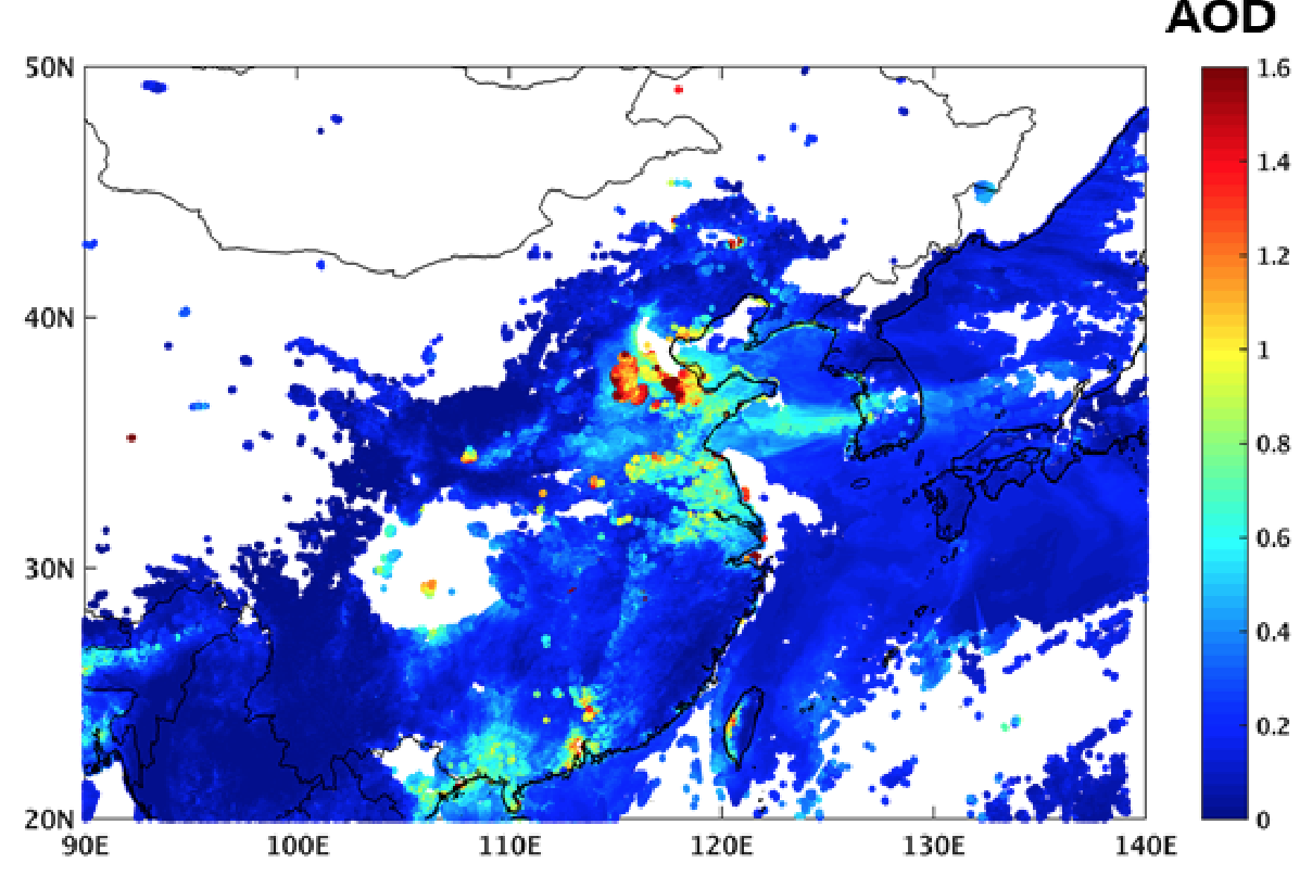
Figure 2. MODIS satellite derived daily composite aerosol potical depth for November 15 and 16, 2019.