
MLO 2.0: A Contingency Plan in the Making
D. Reichler1,2
1Department of Defense Skillbridge Program Servicemember, Boulder, CO 80305; 860-882-8958, E-mail: darrien.reichler@noaa.gov
2NOAA Global Monitoring Laboratory (GML), Boulder, CO 80305
The Mauna Loa Atmospheric Baseline Observatory (MLO) sits at an elevation of 11,135 feet atop Mauna Loa, the world’s largest active volcano. For the past 3,000 years Mauna Loa has erupted on average, every five to six years; the last eruption having occurred in 1984.
On March 25, 1984 Mauna Loa erupted. At the time there was great concern the lava would flow towards MLO, but instead it traveled towards Hilo and took out thirty-one powerline poles, as shown in Figure 1. The observatory was without power for over a month, which caused a wide gap in the non-stop collection of data. Thirty-eight years have passed since then – the longest period of quiet in recorded history – and the volcano is long overdue for another eruption.
MLO is a premier research facility that has supplied data related to atmospheric change since the 1950’s. NOAA/GML is developing a critical backup site, MLO 2.0, to maintain vital, long-term data observations, in parallel with MLO, and in preparation for future volcanic eruptions. This contingency plan will ensure data continuity that is essential for maintaining priority baseline measurements collected in Hawaii.
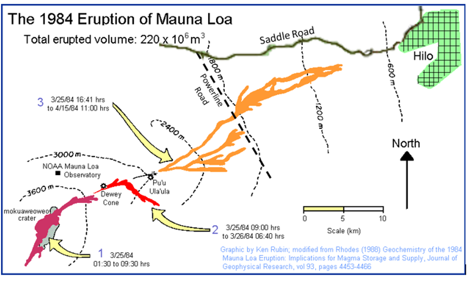
Figure 1. Figure 1: The 1984 Eruption; the flows are numbered 1, 2, and 3 following the sequence of events. The total lava flow was ~220 million m³.