
Study of Precipitation, the Lower Atmosphere and Surface for Hydrometeorology
Overview
From Autumn 2021 through Summer 2023, researchers from the NOAA Global Monitoring Laboratory’s Radiation, Aerosols, and Clouds Division (GRAD) are participating in the interdisciplinary, inter-laboratory field campaign led by NOAA-PSL SPLASH - the Study of Precipitation, the Lower Atmosphere and Surface for Hydrometeorology. Observational platforms and networks are deployed along the East River watershed of the Colorado mountains near Crested Butte, CO. SPLASH is coordinated in conjunction with the SAIL (Surface Atmosphere Integrated field Laboratory) field campaign directed by the Department of Energy and Lawrence Berkeley Laboratory. A main goal of the SAIL and SPLASH campaigns is “to develop a quantitative understanding of the atmosphere and land-atmosphere interaction processes, at their relevant scales, that impact mountain hydrometeorology”.
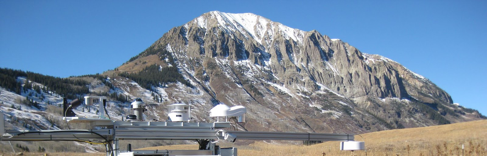
Being able to accurately characterize the surface radiative energy budget for observational process understanding and detailed numerical weather prediction model error analysis in complex terrain is one of the primary research objectives during SPLASH for GRAD. To this end, GRAD field engineers and researchers have deployed two comprehensive stations along the East River consisting of sophisticated radiometers, ceilometers, a total sky imager, a cloud optical depth sensor, and near-surface meteorological instruments. The measurements and valued-added data products retrieved from these measurements are cutting-edge and crucial for advancing the science goals of GRAD during SPLASH (see below).
Web Viewing Tools
Data links
Radiation Data Brush Creek
Radiation Data Kettle Ponds
Ceilometer Data Brush Creek
Ceilometer Data Kettle Ponds
TSI Images
GML Science questions
-
Determine the relationships between energy fluxes, cloud regimes, and boundary layer structure.
- What is the relative contribution of variability caused by clouds to that of terrain in surface radiative heating and land-atmosphere interactions? How much is local surface heating responsible for surface turbulence and boundary layer growth versus from large-scale advection over complex orographic terrain?
- Measure the feedbacks between turbulent heat fluxes, soil moisture and heat flux, and snowpack response to surface radiation separated into cloud regimes.
- Quantify the aerosol direct radiative effect and its variation with aerosol regimes and changing surface albedo.
- How does dust impact spectral and broadband snow albedo via deposition of absorbing aerosols onto the snowpack over the season?
- Identify linkages between dust events and deposition on snowpack for identification of feedbacks to the surface energy balance.
- What is the response of the surface energy budget and boundary layer to direct radiative effects from biomass burning aerosols related to wildfire activity?