Wind Forecasting Improvement Project-3
Overview
Scientists and engineers from the Radiation, Aerosols, and Clouds Division (G-RAD) of NOAA’s Global Monitoring Laboratory are participating in an 18 month field campaign both on and off the coast of northern New England focusing on the physical atmospheric, oceanic, and air-sea interaction components that drive offshore wind energy. The Wind Forecast Improvement Project-3 (WFIP3) is the third and latest installment of a multi-agency, interdisciplinary measurement, numerical modeling and analysis campaign to diagnose the community’s current state-of-the-art understanding of wind energy as a resource for renewable energy production. The primary science objective of WFIP3 is “to improve our understanding of the physical phenomena in the atmosphere and ocean that dictate the structure and variability of the wind resource within the Marine Atmospheric Boundary Layer (MABL)” (WFIP3 Integrated Science Plan). This is a collaborative effort organized by the U.S. The Department of Energy (DOE), Wind Energy Technology Office (WETO) and NOAA Atmospheric Science for Renewable Energy (ASRE) Program partnered with the Woods Hole Oceanographic Institute (WHOI).
Scientific Questions
Specific science questions that G-RAD is planning to address using our measurements and measurements from our WFIP3 colleagues include the following:
-
What are the critical characteristics of the MABL and how do processes at the surface and aloft within the lower troposphere influence MABL thermodynamics and winds?
- How does the diurnal evolution of the MABL correlate with the surface radiative budget?
- Is there a seasonality that contributes to the importance of boundary layer diurnal evolution?
-
What are the effects of clouds on the surface radiative and energy budget and how does the MABL structure vary with different sky conditions?
- How do wind profiles and thermodynamic structure differ for the presence or absence of cloudiness and different cloud types?
- Do clouds with low liquid paths have a significant effect on surface and MABL stratification, and does this impact winds near wind turbine hub height levels?
- Are there responses in surface turbulent momentum and heat fluxes that are sensitive to cloud-induced turbulent mixing (i.e., top-down convection)?
- What are the meteorological factors supporting the formation and dissipation processes of marine fog, and how does the radiative budget contribute to fog lifecycle?
- How well are state-of-the-art numerical weather prediction models at predicting marine cloudiness and its influence on the MABL winds and thermodynamic structure across the WFIP3 field measurement domain?
Observing Systems
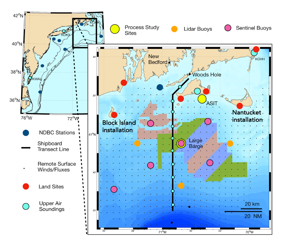
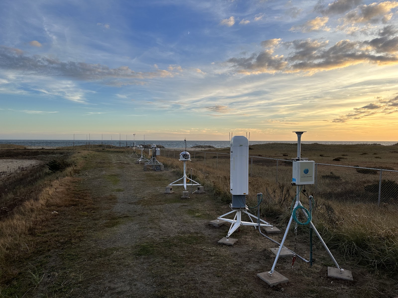
To address the overarching science objective, G-RAD field engineers and scientists deployed two observing systems on two islands of the New England coast, one at the Block Island Airport on Block Island, Rhode Island, and the second more comprehensive system near the south central shore of Nantucket, Massachusetts. While WFIP3 is designed to monitor the atmospheric and oceanic processes impacting wind energy in the offshore, marine environment, the relatively small footprint of these islands and the overlying atmosphere with which we sample from are considered representative of the MABL environment. G-RAD’s systems consist of sophisticated instrumentation to measure the upwelling and downwelling radiative fluxes and solar flux components, ceilometers to profile the vertical distribution of cloud base heights and the aerosol distribution within the atmospheric boundary layer and free troposphere, as well as a total sky imager and near surface meteorology. G-RAD develops software and maintains a number of value-added-products (VAPs) derived from these measurements, and combinations of these measurements, to improve physical understanding of how clouds, aerosols, boundary layer structure, and general meteorological conditions influence the radiative energy budget at the surface. WFIP3 collaborators from DOE labs, WHOI and other academic institutions contribute observations both onshore along the New England coast as well as offshore on a variety of different platforms, including ocean gliders, buoys, and a stationary barge (see map).